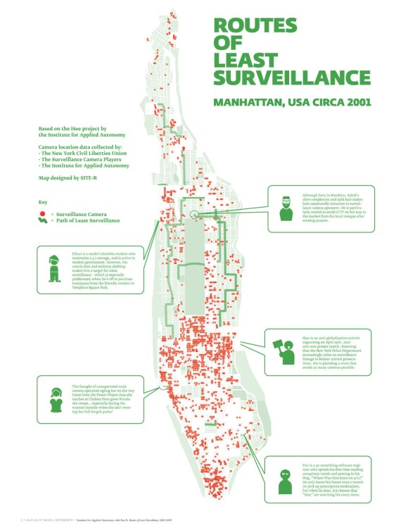
Routes of Least Surveillance (Manhattan, USA, circa 2001)
From “An Atlas of Radical Cartography” edited by Lize Mogel and Alexis Bhagat.
This is a ridiculously cool idea. I’d love to see something similar that used Google fusion tables + a game to map CCTV locations in order to give surveillance-minimized travel directions.
